Monday 29 July 2019

The way home

I won't bore you with the ins and outs of the trip home except the confirm that it was indeed a long boring seven days in the car - and yep - there was no air con. Thankfully it got colder as we headed south. The only minor hiccups were the automatic transmission overheat light coming on in the Dmax middle of the Barkley Tablelands - but it went out as soon as we pulled over and was fine the rest of the way (but I think it's time to buy a Toyata), and Bruce and Daph had a blowout (read, shredding) on the trailer which was a quick change and off we go again. 

It was weird to be back on land. Having just completed this momentous event for us I felt a bit like Frodo Baggins back at the pub in Hobbiton after he came back from Mordor. 

Back in Derby Entrance Caravan Park, we pitched our tents and settled in for our first night back on land - and for some reason we were a bit jumpy about being surrounded by people. Maybe it was because there had been a few issues lately with robberies (it's pretty hard to secure stuff in a boat). Anyway, at some time in the night the kids (who sleep in the boat) decided to go to the loo. As they climbed back into the boat Daz heard them and though someone was robbing the boat. We were all rudely awoken to Daz yelling: 

“PISS OFF YER MONGRELS!!” 

Still half asleep, I shat myself cos I saw a silhouette of someone was climbing into the boat where the kids were. 

So I joined in “PISS OFF! GO ON! PISS OFF!!” As I scrambled out of bed. 

This in turn work Bruce up….”URGRRRRGGGGGGHHHHHHHHHH!!!!” Now he was LOUD!

At this point Jessica whimpered ….”but…” and Daz and I realised it was just our own kids frozen in shock at the steps of the boat. 

Nat:  It’s alright it’s just the kids” 

Bruce: (still mostly asleep)  “UUUURRRRRRRRRRRGGGGGGGGGHHHHHHHH!!!!!”

Daph and Nat: “Bruce it’s ok it’s the KIDS”

Bruce (Still mostly asleep):  “STOP OR I’LL SHOOT!!!!”

Daph: “It’s OUR kids!!!”

Bruce: “Oh aaaa, Uh,  OK, Shit” (sighs and sounds a bit like he might be having a heart attack - which is fine because I'm pretty sure I was having one too)

Daz: “OK then, back to bed” (snuggles down)

Nat: “Darren you BASTARD!!!!! Kids, can you please yell out and let me know next time you need to pee?!?!”

Kids: (whimpered) "OK"

Sleep after that was a long time coming. I'd like apologise to everyone in the Kimberley Entrance Caravan Park for the fright. :-)


So those are all the exciting bits. Now we're just cleaning up and settling back into normal work routine.  Was it all worth 14 days of driving and 18 months of planning. HELL YES!! Buccaneer Archipelago is an absolute wonder to experience and I will forever remember this as one for the books.  I want to extend a huge thanks to Bruce and Daph - I don't know many people in their 30s who do what they do in their 70s #Respect. 

I don't know how we're going to top this adventure...but I'm sure we'll think of something.


Friday 19 July 2019

Sea Leg 4 - Yampi Sound Back to Derby


11 July - Day 17- Silvergull Creek - Dunvert Island

The bloody easterly wind kicked up hard overnight, but we were comfortable in the mpouth of Silvergull Creek. We had planned to fish around Yampi sound today, but the wind was blowing hard and we spent the morning trolling inside Silvergull Creek, until we were worried that the tide might cause us to get stranded in the creek.

So we decided to head to the deeper waters of Coppermine Creek and maybe beach the boats and try oystering. So with Nat at the helm we headed out of Silvergull. It was a bit choppy outside, but with a following sea so it wasn’t too bad. Yet. It’s about 10NM to Coppermine Ck and the last 2 were horrendous. Another choke point between islands, and tide working against a 20Kt Easterly and the surf was up. It was throttle jockey time, go at the same speed as the surf and never look behind you.

Obviously we made it. There was a lovely sheltered beach ahead in Coppermine Creek so we eased into there and beached the boats. We found a nice little cave with shade and a sandy floor so we huddled in there for a while and have a few beers to settle the nerves, then we pulled out the maps and weather reports, and and did a planning session. The weather report was a problem. We had 3-4 days of deteriating weather followed by 25Knot+ entenched easterleys for as far as the reports projected. We agreed that it was time for us to make the rest of the mission about hopping our way home in the gaps between the rising winds which looked like it was going to be our constant nemesis for here on in.

It was on this beach that we finally had a chance to assess the damage to Bundy Runner after the “Bundy-on-the-rocks” incident. There are a few decent chunks of fibreglass out of the bow, but no cracks and it looks like there’s no water ingress. I guess we would have been in trouble before now if there was. We had nothing else to do but wait for the tide to come in and re-float the boats, so we rock hopped around the point and got another great feed of oysters. As is the trend here the easterleys backed off aroung early afternoon, and as it did the white caps disappeared from outside the river mouth. So when the boats floated again we decided to make a run for Silica Beach where we planned to spend the night.

It was an easy run with the weather behaving itself and it only took about 40 mins of driving. But arriving at the beach was a bit of a surprise. While the scenery was spectacular with jutting rocks that looked like a dragon's lair, this was not the sort of place I’d like to anchor up in. If the anchor dragged here the boats would be up on those jutting rocks in no time. It was also quite exposed to the weather so the mooring arrangement would be awkward. So we decided to press on to the known entity of Dunvert Island (where we had stayed on the way north) while the weather was still good.

We went around the outside of Hidden Island and then hooked around into the shelter of Dunvert and were soon anchored up and rafted up with Bundy runner alongside. The big Tawny Nurse shark was still there, so we fed it a couple of Trevally fillets that we’d been saving for crab bait. It’s a pretty good experience for the kids to see these huge creatures alongside the boat getting fed. How lucky are they?

Coppernine Creek - Our Shelter from the Easterleys
Oystering at Coppermine Creel
Jessie getting stuck into the oysters


12 July - Day 18- Dunvert Island - Port Usborne


The mongrel easterly wind kicked up overnight causing a rolling waves to come into our anchorage. From about 2am Bundy Runner bucked around and the boats would bash together and then yank each other sideways. It was impossible to sleep from then and come first light we de-rafted Bundy Runner to go anchor on her own to make it comfortable for everyone.

After breakfast we fished around the area for a while. We had spotted this interesting looking Blue Hole on a satellite photo. So we drove up to it. It was 3m all around the circular lip of the hole, then sheer walls that dropped down to 24 m at the bottom. The deep part was only about 100m across. I can't help but wonder if it’s an ancient volcano crater. As Interesting as the underwater topography was though, 3 drifts across that hole yielded nothing more than some tiny rock cod.

The weather was looking pretty good with the wind having settled down, and everyone was putting the pressure on to get to the next stop for the night. The plan had been to wait till about 2pm so we’d be tackling the tidal rips at Hells Gate on the ebb. But stupidly I let peer pressure get the better of me and so we headed on out way. Sure the weather was fine, but the tidal rips through hells gate were scary as hell. Daz tried to navigate us through a death trap, which I chickened out of, and the “non-death-trap” rout had me shitting bricks too. At first, it was possible to dodge the whirlpools but near the end all I could do was jam on the power and drive through them, hoping for the best. By the time we got to the other side and out of the rips I had promised myself to never bend to peer pressure ever again.

We got to Waterfall beach and holed up behind an island out of the wind which had kicked in again. Once again suggestions were made to keep going to Port Usborne since It was so early. Remembering my promise to myself I agreed to move only near the ebb tide. This led to a few hours of hanging around. We had lunch, Jessie and I had a ‘snotty party” and finished the oysters from yesterday, and we fished for a bit with no notable results.

At about 3pm we made out move to Port Usborne. We found a deep creek that leads up into another big waterway, so we anchored in the creek where we were protected from the wind and moored up for the night. This is as close as you can get to Derby before crossing the open water of Stokes Bay and King Sound. So now we just needed a 3 hour window of opportunity to make our dash. The weather reports are telling us that tomorrow will be a bit shit, but every day after that will be really shit. So we're aiming for tomorrow.

Matilda fished after dark and pulled in a few undersized Redfish. It would be a great place to explore here for a few days, but alas the weather is not on our side. Tomorrow we are expecting 14kt Easterlies. After that it gets worse and worse. I’m worried about the crossing of Stokes Bay in a cross wind and with tidal rips. It can get pretty bad there. So we’re going to have to suck it up and do the crossing in 14 Kts. I’m going to try to time it with the top of the tide so maybe the tide races won’t be so bad. So it’s a 9am departure tomorrow and all going well we should be at Derby by lunchtime.

Sunrise at Dunvet Island
Early stages of Hells Gate - just getting warmed up

13 July - Day 19. Port Usborne - Derby

 
Our 9am departure did not go well. We headed out as planned but the wind and seas around the exposed parts of Port Usborne we're very nasty. We decided to turn back and wait a few hours.

Back in our sheltered waterway, we dropped anchor and rafted up. Daz tried to get a better weather report on the sat phone, but the sat phone was playing up intermittently. On the occasions it worked the BOM 1900 number failed. We asked Bruce and Daph to give it a go on there phone, but after 3 failed attempts at unlocking her sat phone Daph bricked the phone. Eventually Daz did get a report via inreach tracker but it didn’t make life better since it just told us what we already knew. The weather would be getting worse over the coming days.

All we could do was wait and try again in a few hours. While we waited, Matilda fished and hauled in a lovely big cod (60+) complete with cockroach-like parasites burrowed into it's face. Ewww.... Then a roaring sound grew louder and a boat rounded the corner. We waved him over and asked for some tips about getting back to Derby on this tide and weather. Old mate said “ahh yeah maybe try again at midday - the wind should have dropped a bit by then. You’ll get into Derby with just enough water”.

He was right.


We headed out again at 1130. At Port Usborne it was still pretty rough, but a bit better than a few hours ago. So we decided to go for it. Settling in for a long rough slog we began our last leg home. Thankfully the rough stuff lessened as we crossed Stokes bay, and by the time we passed Point Torment it was positively comfortable. Inside King Sound proper, with plenty of fuel and only a slight brown chop we throttled on to race home to beat the outgoing tide. We did it in the nick of time with only 4m of water to spare over the drying sandbars near Derby. But we were back at the boat ramp.

After dropping off Bruce and Daz at the ramp Daph and I waited around and lowered all the rods and aerials. About 45mins later the boys arrived and backed the trailers down. Daph and I drove our respective boats onto the trailers without incident and that was that. Water mission over. What a weird feeling.


Our last night on the Water


Matildas Cod - Complete with parasites coming out it's nose


Hangin out at the Derby boat ramp
Time to leave the water :-(
Feet Dry


The Captain's Log - Daz's meticulous record keeping of Fuel and Distances

Wednesday 10 July 2019

Sea Leg 3 - Doubtful Bay back to Yampi Sound

7 July - Day 13 - Raft Point to Sale River - 32nm/ 65km

Turns out that the 15mins of chugging last night only resulted in us moving about 200m. Sure it was enough to get us to a better anchor holding and out of danger. But it’s a testament to the incredible strength of the tidal currents in this place, and how darkness really messes with your senses.

After Brekky we decided to head over to Red Cone Creek for a look. We could either stay there the night, or move onto the Sale River once the tide was higher. Well apart from providing some good photo opportunities looking back at Steep Island over the glassy water, Red Cone was a big fat waste of time. The tide was dead low so all the mangrove forests (and I do mean thick creepy old mangrove forests) were about 300m beyond wide mud banks. We trolled around for a bit with the only bit of joy being a foul hooked Mackerel.

So we gave Redcone the big A and headed towards the Sale River, stopping to troll and flick lures at a little inlet along the way (again without any luck).

Just before arriving at the Sale River a pretty strong southerly wind kicked up so we high tailed into the Sale. The tidal currents reacting with a rock bar at the mouth of the river  was churning up white water and I had Daz calling out directions to me based on satellite photos to help avoid the rock bar. (this river is unsurveyed on the charts so the satellite photos are super helpful).

Anyway, we made it through near the top of the tide and headed up to an anchorage point about 6 nautical miles upstream. Since it was only early afternoon I picked a random spot with a nice deep hole and a back eddy and dropped anchor to do a bit of bottom bashing.

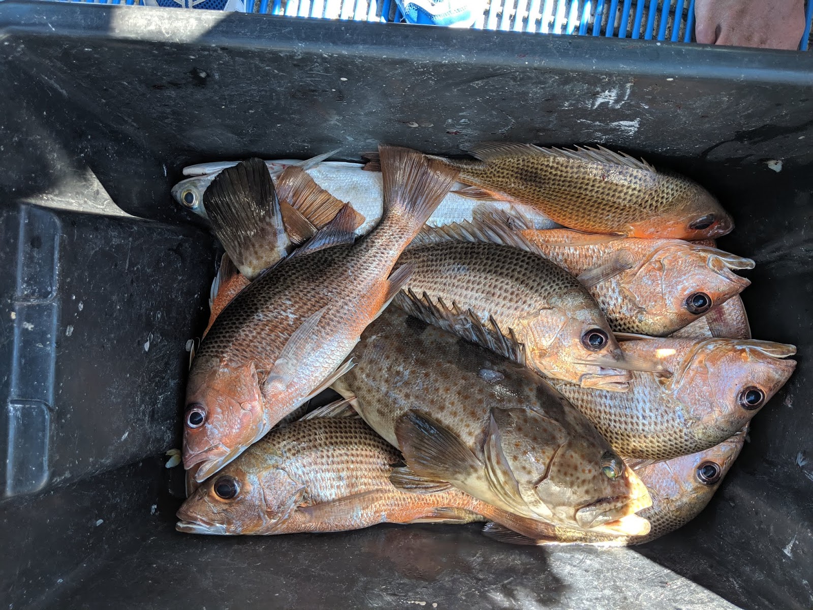
Well what a spot! Within 5 mins I had landed and released 2 small fingermark. 5 mins after that I had landed 2 more big fat ones (keepers) and everyone was starting to look at me like I was possessed with fish magic. Then they all started pulling out more fishing rods and joining in the fun. We told Bruce and Daph and soon they come over and anchored near us. By this time I had landed 2 more keepers and the kids were having some success too, so I assigned myself deckhand duties and we had a wonderful afternoon as the kids hauled in fish after fish. Daz went up on the bow with the micro jigs and also pulled in plenty of fish. After we bagged a dozen or so the whole family pitched in cleaning them and Daph and Bruce also did the same.

We’re now feeling a lot better about the fishing!

After that we chugged away from that lovely fishing hole and used the Active Captain tracker to map the contours for the river floor, then pick a spot to anchor. Since we all smelled a bit fishy, we pulled out the fresh water shower and we all got ourselves nice and clean, threw our smelly clothes in the shower water and settled down to Mackerel for dinner.

After dinner we sat and marvelled at the strength of the tidal flow in this place. The water was racing past the boat at maybe 20-30kmph. It unbelievable to see. At about 8pm (an hour before low tide) the incoming tide started pushing upstream causing whirlpool just behind the boat. We could hear the whirlpools erupt by the sound of slurping water (a bit like the sound of water getting sucked down the bath), then we’d shine the torch on them and just watch the water action in wonder. The forces of nature here are really something to see.


Heading from Raft Point into Doubtful Bay

Looking back to Raft Point from near the mouth of Red Cone Creek

Captain Daz!


Red Cone Creek


Our secret Fingermark place in the Sale River

Fingermark I tell ya!

The tice creating some push in the Sale

Sale River - SUnset at our anchorage
8 July - Day 14 - Sale River

Well the Whirlpools didn’t suck us under. In fact we had a very peaceful night’s sleep with no anchor alarms, drag alarms, wind or surging waves.

After Breakfast, Mum & Dad fished in the same spot as yesterday so we chugged upstream a bit and found another likely spot. Soon we were hauling in more Fingermark and Mangrove Jack and then Daz Showed off by pulling in a 75cm Jewie. Bruce and Daph came up then so we cleaned our fish and used the incoming tide the go up to about 1km from the rock bar (about 20km upstream). Since the GPS didn’t chart the river we used the satellite maps as a guide to dodge the sandbars, and as we progressed upstream, the sides of the river rose on both sides into huge splendid cliffs with amazing rock formations. What a beautiful place. We cast lures for a while into the mangroves in the hope of snagging an elusive Barra, but again it was not to be. So as the tide stalled and begun it’s outward run, we headed back down the river to our anchorage and watched the setting sun light up the huge cliffs.


Daz prepping to fly his drone over the Sale

Looking upstream from our Sale anchorage


The Sale River

Daz's nice Jewie

A decent haul of fish. Not bad of about an hour of fun

But guess who has to clean them all?


Daph with a 50cm Fingermark


Exploring the upper reaches of the Sale

Sale River cliffs


The view from our anchorage as the sun sets


9 July - Day 15 - Sale River - Raft Point.
After another night in the Sale, where the tide didn’t quite run so hard overnight thanks to the incoming neaps, we went for one last fishing session back at the Jewie hole. Both boats soon bagged out, and cleaned the fish, and so on the rising tide we bid farewell to the wonderful Sale River. 

Fuel on this leg of the trip is a constant worry. We need to conserve enough to get back to Cockatoo Island for resupply and this leg we’re covering some LONG distances. So every mission is carefully potted and calculated against the fuel reserves before we do anything. Surprisingly it seems like our consumption is coming in under what we planned, so we have enough to stick our noses through Success Straight and into George Water. Success Straight on the incoming tide was well worth a look for the scenery and just to experience the might of the tidal currents. 

I was driving and I don’t mind saying that I was peaking a bit with adrenaline going through there. The currents made the water top glassy and pushed the planing boat left and right sideways (like fishtailing) and at one point I had to swerve to miss a whirlpool that in it’s centre was about 1m below water level! Scary powerful shit right there. I was glad to have experienced it, gladder to be alive, and gladder to be out of it.

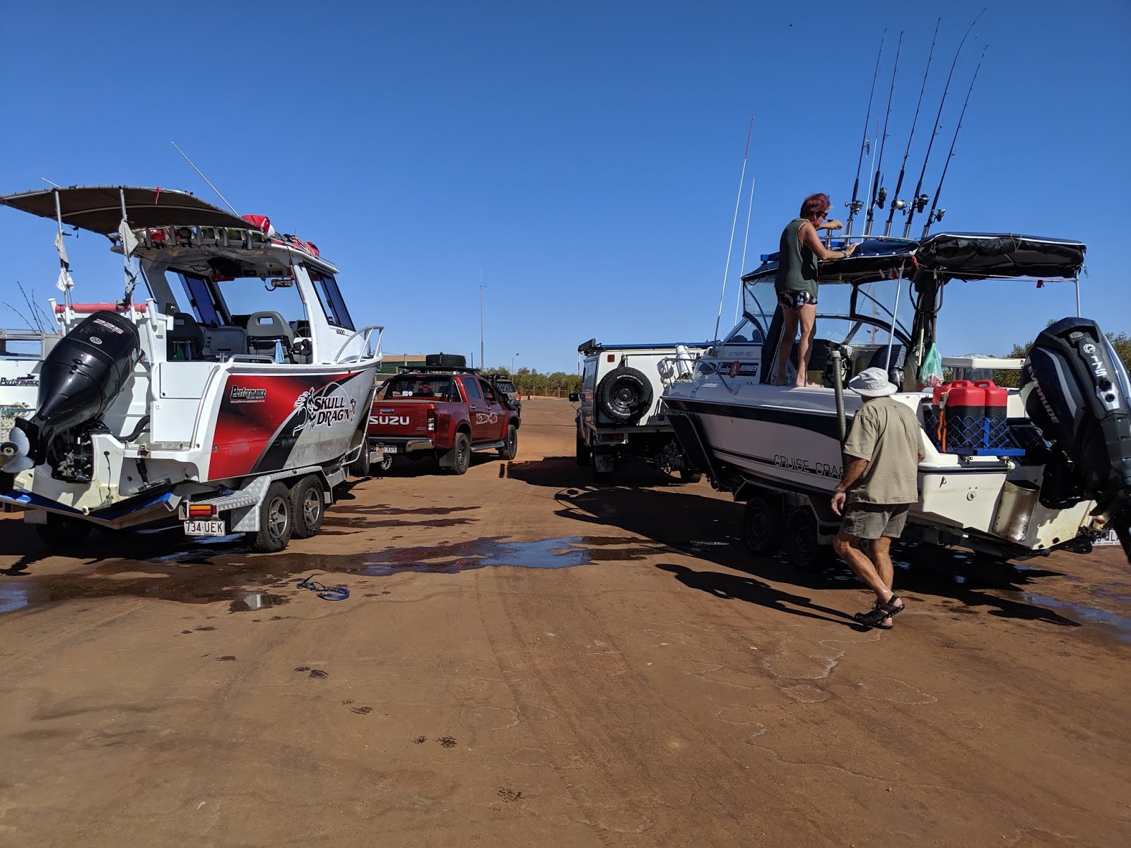
Back out of Success Strait we headed across a pretty choppy Doubtful Bay and into Raft Point. It was like Pitt St in raft point with a massive passenger ship holed up there and a few other boats. Later in the evening more big cruisers lobbed in to get away from the wind that had been kicking up all day. Many of them only stopped for a few hours and then headed back out again.

With Bundy Runner rafted along side of up we settled in for the night. But Raft Point isn’t all that well protected from the wind and currents and soon we had to re-think the anchoring situation as the sloppy conditions was bashing the boats together, making it hard to stand. So we set Bundy Runner free and they went and anchored on their own. It made for a much smoother night.


Bruce and Daph get another nice haul

Matilda bag this fat cod. It was fat because it had the whole head of a fish I'd just cleaned inside it's belly.


Back at Raft point...

My other boat is here to greet us

Or maybe they're sitting there drinking sundowners and scoffing at us peasants

A busy night at Raft Point


10 July - Day 16 - Raft Point - Montgomery Reef - Cockatoo Is - Silvergull Ck
We wanted to see Montgomery Reef near low tide, so it was up early and straight out to the Reef. The easterlys had kicked up over night and was making it a bit choppy, but it wasn’t too bad and we made it to the reef in good time. We made our way up the narrow channel and hung around on the anchor for a bit to see the spectacle of the waterfalls cascading over the edge of the reefs.

Personally I don’t think “reef” is a very accurate description. It’s more like a bloody great big rock. It’s nothing like the colourful coral reefs of the Great Barrier Reef. It’s just solid brown smooth stone.

The waterfalls were pretty cool though and they got more impressive the further up the gutter we went. We had a troll up and down the gutter, but after Matilda hooked a huge sea turtle and we had a hell of a fight freeing it, she gave up, mortified that she might have hurt a turtle. Instead Daz hooked up on something MASSIVE that went SPLASH, GULP, zzzZZZZZZZZZZZZZZZZZZZZZZZ, PEH. We can only speculate it was a big spanish Mackerel, Since all that was left of the rig was a piece of chewed through wire leader (right up near the top) - I guess we’ll never know now.

We had a bloody long haul left ahead of us to get back to Cockatoo Island for fuel, So we got ourselves ship shape and headed out with captain Daz at the helm. Things went well for the big open stretch, but as we neared Melomys Island things got a bit gnarly. There was one hell of a tidal race going through the gap between Melomys and Traverse Is
 and it was running against us, while the wind was behind us. So the pass was a long stretch of white capped standing waves. WIth Nat on windscreen wiper duty, Daz punched his way through it with Bundy Runner on our tail. It was a long stretch of pretty intense driving. 

Once in the clear, we had a quick conference with Bundy Runner and agreed to make a dash through the Koolan Channel despite the incoming tide. We just wanted to get back to base! So we picked our way through more tidal races between islands and in through the gutter at the bottom end of Koolan Island which was pretty frightening. The current in that place was mammoth as the tide was going at full roar. You’d be going backwards if you attempted it in a lesser powered boat, so full noise on the motor and you wanna be sure you keep your bow pointing dead straight into that current or I reckon you could flip it in a heartbeat. It was 10 seconds of terror. Then we were through, and into the main Koolan Channel where we got some respite, until we crossed the washing machine of Yampi Sound to reach Cockatoo Island. Phew.

The tide was still a bit low to fuel up, but we moored up and waited, had a few beers (and some valium) and a rest, and an hour later we were able to pull into Cockatoo Island and fill up on fuel and water and ice.

After that we headed back to SIlvergull Creek for the comfort of a bloody good mooring site. That night we were joined by 4 other speed boats like ours.


Montgomery Reef


Water flows off the rock caused by the falling tide

The waterfalls grow as the tide drops


Bundy Runner enjoying the specticle at Mongomery Reef with Raft Point in the background


Montgomery


My other other boat....

In the next leg we race the weather back home to Derby...

Saturday 6 July 2019

Sea Leg Number 2 - Talbot Bay, Horizontal Falls, Dugong Bay, Raft Point

Day 7 - 1 July - Silvergull Ck

The good news is that Bundy Runner doesn't seem to be sinking after the "Bundy on the Rocks" incident. In fact, what is strange, is the the slow leak that it had beforehand seems to have stopped too. Perhaps the wood around the transducer inlet has swelled up a bit and plugged the leak? Anyway, we're grateful for big mercy's. Thankyou ocean gods! 


After refuelling yesterday we anchoured at the sheltered entrance to Silvergull Creek. After a slow morning and a cooked Breakfast, we headed up Silvergull Creek as the tide neared high. Inside Silvergull Creek were more cliffs and on the left there were quite a few chasms that entered the creek proper. No doubt these would become raging waterfalls at certain times in the wet season, but at the moment they are dry, but still really beautiful. We did a bit of trolling and lure flicking off the bow, and Daz landed a nice cod flicking lures.

There's a place up this creek called “The Squatters Arms” where a couple set up their home years ago and did a mighty job at it. It was empty when we called in but there are signs of habitation, with old gardens, buildings and tools around, and a few huge canvas tents set up on top of a hill.  We explored the beautiful scenery upstream of the Squatters Arms before doubling back and pulling Skull Drag’n up alongside a rocky shelf. Going ashore we found a little slice of tropical paradise, complete with a loo with a view, and a concrete water tank with a non stop supply of fresh spring water, a wet bar (BYO) and an “infinity window” cut into the side with a million dollar view. 


At first the kids wouldn’t get in the pool, but once I got in and proved there were no snakes or spiders they were in like flynn. Fresh water swimming after a week on a boat...Hell yes!! Daz joined in and then Bruce and Daph came in for a shift while we looked after the boats and kept an eye on the tide. The tide was beginning to run out, and mindful of boats being stranded, we had to be on our way. 


We trolled out again and Dazza picked up a Mangrove Jack, Then we headed out to check out Dog Leg Creek, with the intention being to anchor up there overnight. But Dog Leg Creek wasn’t such a great anchorage so we did a bit more fishing near the incredible rock formations of Nares Point and then doubled back to anchor up out the front of Silvergull Creek again. 


We had fresh whole fish for dinner tonight, and tomorrow we’ll head down to the Horizontal Falls.

Going for a troll up Silvergull Creek


Chasms in Silvergull


Nat flicking lures in Silvergull


Skull Drag'n visiting the Squatters Arms


Loo with a view

Tilds Exploring the gardens around the Squatters Arms


Looking along Sulvergull Cteek from the Squatters Arms


Daz and the Girls looking for the pool


Found it! 
Warm spring fed concrete watertank with it's own infinity window with a view. A freswater swim - pure bliss!


We're never gunna get them out....


It even has a warm waterfall!


Skull Drag'n at the Squatters Arms


Dazza flicking lures - He's the Mangrove king


Another chasm offshoot to Silvergull Ck


Day 8  - 2 July - Silvergull to Horizontal falls - 49nm/ 98km

We got going a few hours before the high tide and cruised on down the Koolan channel. The Iron Ore mine there is a sight to behold. Looks like the broken sea wall is repaired and mining (or something that causes dust plumes) is happening in that deep hole below sea level. The rust coloured terrace of the mine walls are enormous, and there’s 2 tug boats moored out the right side of the channel. 

Further along the channel narrows, and we followed a previous path on the GPS through the narrow passage out and around the Iron Islands. The Active captain track we were following went to a different place so we stopped and marked out a track down past Molema and Slug islands into Talbot Bay. The path was riddled with  whirlpools and broils despite being really deep for the most part. We could tell we were nearing the Horizontal Falls by the flotilla of ships, pontoons, seaplanes and helicopters up ahead. 


We arrived at the Horizontal Falls after about an hour of driving and went straight in to take a look. Despite the tide chart saying it was a bit after high tide, the Horizontal falls were still filling, and there was a bit of white water and maybe a ½ m difference in water height, so we lingered around the  top end of them for a while and took photos while the tourist boats roared in and out. Then we went up to the floating city nearby and had a chat to the staff, while the Tawney Nurse sharks lolled around the boat, wowing the kids, 


We booked ourselves onto a 4:30 boat ride  ($77 per head) which was when the tide should really be roaring, and then killed some time by exploring Cyclone Creek for a few hours. Daph and Bruce caught a few nice Cod, but Matilda got busted off by something BIG. Big enough to snap the trace. Cyclone creek is really quite spectacular. Like the Horizontal Falls, the is a tight point called “The Drain” where the tide really rips through creating whirlpools and strong currents. But it doesn't get full on like the Hoz Falls so it’s safe to drive a boat through, as long as you keep the power on to maintain steerage. 


After a while we went back out front and anchored up Skull Drag’n near the other moored boats and all piled onto Bundy Runner to go to the pontoons and get on the boat ride through the Horizontal Falls. 


Wow - what a ride!!! It was a spring tide at full roar. Words are inadequate to describe the forces at play in that chasm. There are 2 gaps in the Horizontal falls. The First gap is the wider of the two (6.5m), and the mighty whirlpools would have destroyed our boats about 30 metres before we even hit the gap. The boat we were on had 3 x 300hp outboards on it, and when the driver put the throttle forward they just purred and that boat leaped UP the 1m fall that was coming towards us in the first gap. Wowee! Then the water opened up either side of us into a small bay and the driver fanged the boat around so tight you could feel the G forces pushing sideways. Then we smashed back down the fall again. My adrenaline was definitely pumping. 


We did that a few more times and then the driver went up the falls and across the small bay right up to the 2nd gap. This gap was narrower and the water on the other side was 3m higher than we were! At this point I couldn’t remember if the boats went through the second gap (maybe I forgot to ask) but holy shit the way the bloke was driving it looked like we were going through!! There’s no WAY we’d fit through it surely! There was a gnarly bit of rock hanging out the left side that would almost certainly hit the boat and kill us. Or even if it didn’t the force of the water was terrifying! Everyone was screaming at this point and at the last minute the driver pulled back on the throttle with the bow of the boat steady in the churn of the bottom of the fall. 


After we all finished shitting ourselves we did that a few more times, got a bit of a speel about the falls from the driver. The top fall (the one we didn’t go up) is considered the most turbulent water in the world. 


Anyway $304 was done in about 15 minutes and our thrill ride was done. After we got back to the pontoon we hung around for awhile and chatted to the staff and a few yachties who we’d bumped into first at Dunvert Island. There is a caged swimming area in the pontoons as well and a few of us had a quick dip (refreshing ahhh!) before we all piled back onto Bundy runner and rafted up with Skull Drag’n again, we had dinner and settled in for the night.


Fully layden Skull Drag'n on the move


Nares Point 


Koolan Channel - Iron Ore mine in the background


Heading down Koolan Channel


Coming through the drain at Koolan Channel


The Horizontal Falls near the ebb tide


Skull Drag'n inspectin the falls


Bundy Runner at the Horizontal falls


Daz and Girls at the Horizontal falls in Skull Drag'n


Horizontal Falls - the Flotilla 


Sea plane landing in front of Cyclone Creek


Seaplanes at the Horizontal Falls


Boarding the Horizontal Falls flotilla 


Ready to rock the Horizontal Falls with 900 horses


Just a couple of random Grey Nomads. They are just checking with the driver that the boat won't do more than 90kmph or the wind will mess up their hair


Horizontal Falls - the WIde gap


Horizontal Falls - the narrow gap


The narrow gap


Day 9 - 3 July -  Hoz Falls to Dugong Bay - 26nm/ 53km

With the Horizontal falls done we decided it was time to go check out Dugong Bay. But since we were now dealing with spring tides, the safest time to travel is for the few hours on either side of high tide, when there’s plenty of water (about 9m more!) and the whirlpools aren’t so dangerous. So we spent the morning fishing and exploring upstream of the drain in Cyclone creek. Matilda (sort of) caught a nice Cod. By sort of I mean, She had a line out the back as we trolled, but boredom had finally got the better of her and she was playing “go fish” with Jess and a deck of cards as we trolled. Daz was on the bow flicking lures. I was driving and turned around to notice Matilda’s line was going off. 


“Matilda!! Fish ON!!” She finally noticed and spent the next 5 minutes realing in a very nice cod. Personally I think that should have counted as my fish. 

We spent a few more hours chugging right up that creek until cliff faces gave way to mangrove flood plains. Bundy Runner saw the first croc of the trip up there but still we caught no more fish. So we worked our way back down the creek and prepped for the high speed leg to Dugong Bay. 

On the way through we stuck our noses into the Horizontal falls for one last look and some photos, and the we legged it to the majestic Dugong Bay. We found a place to be a likely anchorage, but had a few hours to kill so we zoomed over to Butterfly Falls and Turtle falls on the other side of the bay.


Sadly the wet season this year was a bit pathetic so the falls weren’t running (maybe the were leaking up behind the mangroves as there were pandanus palms growing up there), but we couldn’t get to them, so we had to settle for admiring these breathtaking georges from afar. So we trolled a bit more. Daz bagged another nice cod flicking lures from the bow. And Bruce and Daph came away with a good sized fingermark. We trolled and trolled and eventually I got to have a turn flicking lures off the bow. I’m pretty sure I spotted a barra but buggered if I could jag one. We did see a little croc though, and this sent the kids into a frenzy of excitement. 


It was getting late in the day so we went back to our anchorage and rafted up. “Lemmeny” the Tawny Nurse shark that we initially thought was a lemon shark promptly moved in and circled the boat like a pet dog. I couldn’t help myself - I pulled out a little bite sized trevally and fed a rope through it and dangled it over the side. Lemmeny brushed past it a few times and eventually took the bait. Thus commenced Nat Vs Lemmeny Tug-of-war game. Boy Lemmeny was strong and resorted to doing death rolls while I started to freak out that Lemmeny would swallow the fish rope and all! But it was ok. After a bit of a tussle the rope tore through the fish and Lemmeny got his tasty treat. The kids found the whole episode (particularly the bit where I stated stressing that the shark would swallow the rope) pretty funny.


Later that night, the tide going out and out and out, and me getting worried that we’d end up high and dry (we got down to 1.8m) we spotted crocks eyes in the dark. But the ever present Limmeny remained our only close company and we didn't dry out.


Matilda's Cod up Cyclone Creek


The Drain - Cyclone Creek


Upper reaches of Cyclone Creek - we're off the map!


Cyclone Creek


Daz having a shower at Dugong Bay


Sundowners on the flight deck


"Lemmony" - the Tawny Nurse Sharke


Dugong bay


Feeding Lemmony - Dont worry - there were no hooks involved. Lemmony just munched up the fish and spat out the rope


Day 10- 4 July -  Dugong Bay to North Yampi - 24nm/ 48km


This morning we awoke to foggy cascades coming down through the waterfall chasms and suspended on the surrounding ranges. The view was like something out of a fantasy story. Every surface on the boats were wet and covered in millions of tiny unfortunate bugs who got stuck in the dew and died there, and the ever present Lemmeny circling the boat. With the tide out and nowhere to go Daz did a bit of drone flying 


Once photos were taken and breakfast was done and the boat cleaned up of glued on bugs, we worked our way out to a bit of foul ground (shallow reef)  and tried to bottom fish. We didn’t do any good. Daz pulled in a whopper of a Papuan JawFish (which was really beautiful, but still a shit fish). Not to be beaten Daph put in a 20 fight against something massive ... which turned out to be … Lemmeny?? Is that you? (We hope not). The Shark was sent on his way, and we give up on the bottom fishing and went back to trolling and flicking lures around the mangroves on the incoming tide. Still No good!! WTF is going on with the fishing in this place? We’re in the wilderness and can’t seem to get onto some decent fish. We did spot another croc though. 


So we gave up on the fishing and decided to head for Yampi North. We plotted ourselves a course over “virgin ground”, meaning we had no Idea if this was going to be deep/ shallow / passable etc until we intercepted a known path on Active Captain. (Active Captain is a newish feature on our GPS that allows you to see the previous paths of other boats who recorded an Active Captain track themselves - it shows where they went and the depth of the water as they passed over the spot. It’s very handy for identifying safe passages when exploring areas that you’re not familiar with) 


The course we set to intercept the active captain path was a bit dodgy (less than 10m) in places and we slowed down and used out satelite photos to try and keep to the deepest water. Once we intersected the active captain path we were back in 30+m and able to zoom up an unnamed creek to what looked like a good anchorage. 


Anchorage confirmed, we tried fishing again. And again we bombed out completely. We’ve all got RSI from flicking lures and the country looks perfect and untouched. But the fish just aren't biting. Not that we can complain. If you’re going to fail at fishing, this sure is a spectacular place to do it. On either side of our creek are chasms that you can drive up a fair way into. We explored quite a few and the scenery is amazing. The way the rock seems to have been folded and rolled and levered up into the great cliffs is something to behold. I’m sure that given a better wet season all of these chasms would be flowing with fresh waterfalls. And I can't help try to imagine what forces of nature asserted themselves to create this incredible landscape.


So another anchorage in the creek, and finally a creepy croc encounter! Scanning with the torchlight showed up a few sets of glowing red eyes, and just before bed time a 3.5m croc came right up to the back of the boat. We were all a bit excited/ amazed/ creeped out, and yeah, we slept with the croc repellant nearby just in case he figured out how to get in the boat. But of course it was unnecessary. Next morning there was no sign of our creepy croc friend, and no one got eaten in the night. 


Nat getting a sleep in...


Foggy morning in Dugong Bay


This is a waterfall in the wet season - but today it's a fog-fall


Butterfly Falls is full of fog


Drone shot of Dugong Bay


Drone shot of Dugong Bay


Jessie making pancakes for breakky while Lemmony cruises around the back looking for a feed


Daz's big Papuan JawFish


Evening time at an unamed creek in North Talbot Bay


Scenery near North Talbot Bay


Above: Creepy Croc Encounter


Day 11 - 5 July - North Yampi - Crocodile Creek - 26nm/ 53km

It was another slow morning since the tide was out at dawn. We couldn’t do much until the tide was much higher, so we had a slow brekky and then set off for a bit more creek fishing until about 11am. Once again the trolling and flicking lures into the mangroves yielded no results, But Daz and I did get to check out another gully that led to sheer cliffs blocked off by dense mangroves. Certainly another waterfall in the wet season. But still unaccountably, bugger all fish. 

So at 11 am we readied ourselves and then sped back out of Yampi Sound, up through the Koolan Channel heading for out new anchorage, Crocodile Creek. 


The Yachting guide warns that Croc Creek can be a bit treacherous with submerged rocks etc, so we carefully chugged up the creek. What became increasingly apparent, was that we were in fact up the wrong creek!! Months ago when we were planning the trip we must have accidentally plugged the wrong waypoint into the GPS and now here we were in the wrong place! Oops. There was no harm done though apart from a bit of a dent in the pride, so we soon corrected out wayward waypoints and entered the REAL Crocodile Creek. 


It’s a fairly nondescript entrance to the creek. We were nearing the top of a 9m spring tide and the depth was a fairly constant 5-6, meaning that the whole creek dried out on the low. Nevertheless, we had time on our side so we chugged up carefully until the creek took a sharp narrow right turn, then opened up into a small amphitheatre surrounded by rock cliffs on either side. Dead ahead was a small gap in the rock cliff that you could squeeze boat through. Through the gap we could see a rock wall with a waterfall cascading down it, and what looked like a concreted picnic area. 


Daph and Bruce nearly drove through the gap, but I re-re-re-read the cruising guide and advised “better not”. Closer examination revealed some ropes at water level on either side of the amphitheatre, and the top of a stainless steel ladder (like the sort you see at the local swimming pool) just under the water surface in the small gap that led to the next pool. Beneath us, in the amphitheatre, the depth had plunged to a deep hole of up to about 15m. 


I was getting a few dubious looks from Daz but we decided to give this a go. After all, we didn’t come all this way to not experience the Kimberly Coast with its full offering. So we asked Bundy Runner to go back out while we fart arsed around with anchoring and mooring lines so we could spend the night in the amphitheatre. It took up maybe 20 minutes to get sorted out. First setting the bow anchor up in the shallow area, then reversing back into the deep amphitheatre and securing a loop for a stern rope to the top of the ladder just under the water. Then a bit of tricky driving and ropework had us looped onto the port side rope, then we pulled tight all the ropes to get ourselves nicely positioned in the deep part of the amphitheatre. 


Then it was Bruce and Daph’s turn. They came in and snagged the rope on the Starboard side and a bit more fancy driving, then we rafted them onto our starboard side. Mission Complete! And did anyone argue? Of course not!


In the time it took to do all that the tide turned and started running out.  The top rungs of the ladder were now a foot above water level. For the next hour or so we did boaty maintenance things and watched the tide drop at an alarming rate. Soon, that ladder was about 4m out of the water and that narrow gap we considered driving through had turned into a rocky waterfall about 3m high, plunging down into our amphitheater in which we were moored. As the tide dropped the ladder got longer, as did the waterfall, and the waterfall got louder. 


At the other end of the amphitheatre, a rock bar appeared and the water on the other side dropped and dropped till it was about 2m below us. We were now moored in a landlocked crater with a waterfall flowing in at one end, and a waterfall (sort of) flowing out at the other end. The cliff walls on either side of us loomed higher and higher. It was spectacular!!


But wait there’s more…..


Later in the day we pulled up on our stern rope which got us to the ladder. We managed to all safely transfer from Skull Drag’n to the ladder, (now about 5m high) climb the ladder and enter the second pool. Some people swim here but it is open to crocs at high tide and the water was murky and salty, so we mountain-goated our way up another rock face and there we found heaven! A freshwater,  croc free, pool!! Our first fresh water swim in two weeks!! It was a little piece of paradise.


We eventually arse-walked our way down the rock face again and made use of the BBQ facilities to burn off some rubbish. Someone has been to a lot of trouble in this place, concreting a nice flat area and BBQ facilities, there’s even a bunch of old steel sprung bed frames concreted into place halfway up a rock face (obviously no longer in use).


Upon returning to the ladder the tide had dropped even further so it was about a 7m climb down the ladder back to the boats, where we settled down to spend an evening in a very strange place. 


Our Anchorage in Crocodile creek at high tide
As the tide drops the ladder and a stone ledge appear


....and at low tide - the waterfall and ladder emerge in the narrow gap as the tide runs out


So we go exploring....


And find a picnic area
From the Picnic area you can either choose to swim in the salt water pool (maybe with crocs), or you can climb the rockface and swim above that fresh waterfall...


...and so we climb to the fresh water falls...

....and get in a nice swim


Meanwhile the tide keeps going out and the boats are dropping lower and lower


Bruce back on board for refreshments


Matilda - where did that waterfall come from??


Drone footage of Croc Creek


Drone footage of Croc Creek


Drone footage of Croc Creek


Drone footage of Croc Creek - looking downstream - we're landlocked


Downstream - Totally landlocked in Crocodile Creek


Day 12 - 6 July -  Croc Creek - Cockatoo Is (fuel) - Raft Pt - 65nm/ 130km


Overnight the tide rose another 9m making the waterfalls  infront and behind us dissapear again. It’s weird - the sound of plunging water just fades to nothing, silence settles, then slowly the sound re-establishes itself into a healthy roar as the tide drops again. Next morning the tide was low again and we had about a 4 hour wait till it was deep enough to get out. Daz Did a bit of drone flying and I caught up on blogging. 


Once we were out we headed over to Cockatoo Island for Fuel and Water resupply. It was time for the longest leg of the trip - up to Raft Point, Sale River and Montgomery reef. We’re going to need to carry as much fuel as we can, and conserve it. 


Bruce & Daphs fuel Bladder was discovered to be leaky on the first leg of the trip, so they're using Jerry Cans instead - having converted 2 of his water Jerry’s for fuel. We’re also as full as a goog with 260L of water, and 480L of fuel.  Nautical Nick (whose real name is Mick) at Cockatoo Is was super helpful too, setting us up with some coke zero (the whizz fizz for making coke is bloody useless) and Ice (since the Waeco freezer fan shat itself we’ve converted it to a storage box and reshuffled the cooking gear so we can use the big blue esky as a fridge)…….


Once we were all loaded up to the brim we decided it was still early enough and the tide high enough to get us at least part way to Raft Point. We wanted to burn off as much fuel as possible to get rid of the bladders off the floor so we would be able to have room for our beds, so it was off down the Koolan Channel once more and out past the Iron Islands and into the open ocean for the long haul. 


The open ocean was lovely and calm so we keep rolling all the way to Raft Point (It took about 3 hours). On arrival the tide was absolutely tearing through Foam Channel but the boats didn’t care and made easy work of it. Around into Raft point there was Steep Island all lit up and bright orange in the afternoon sun, Mirrored by the huge bluff at Raft Point. Just Beautiful! Sometimes I have to pinch myself - are we really doing this?


We picked a spot to anchor having had enough of driving. There were a couple of Yachts on one side so I decided to steer a bit clear of them. That was a bit of a mistake. We’ve crossed 2 tide charts and now we’re into 11+ m spring tides. Finding a spot that was deep enough to not dry out on the low, but not too close to the cliffs was a bit difficult. So for better or for worse we picked our spot and settled down for what turned out to be a pretty unsettled night. 


There was a bit of a surge coming in which made the water sloshing on the boats noisy, then Bruce and Daphs Fuel fume detector kept going off over and over again. There wasn’t much they could do about it. Then something changed which set me on edge, the boat movement, or the sound of the waves alerted me to something being different. So I was up and consulting the GPS and checking the surrounds by torch when the drift alarm went off (a sign that the anchor might be dragging and we were only in 2.5m of water. Shit.


So Daz went up on the bow to pull up on the anchor rope while I manned the motor. Pulling up on the rope indicated the anchor was still set, and shortening the rope gave us an extra few metres of depth. So we decided to leave it at that and see what would happen. So we settled down again to the sound of Bruce and Daph’s fuel fume alarm going off every 10 minutes. 


But I wasn’t going to sleep. I could hear the waves lapping on the nearby cliffs and was thinking of all the scenarios that could happen to bring us to grief. The tide coming back in with us not having enough rope out could lift the anchor and make us drift into the rocks. An easterly wind could also swing us onto those rocks. After a few hours of fearing the worst I decided that we should move. So Daz and I roused the crew and with Bundy Runner still tied alongside we pulled anchor and chugged towards the yachts. It was a good 10-15 mins of chugging before we were happy and we reset the anchor again and FINALLY settled down to sleep with some peace of mind.

Bundy Runner on the move - heading to Raft Point


Raft Point


Steep Island


Anchored up in Raft point looking towards Doubtful Bay


Confidence inspiring, isn't it....  ;-)

Next Leg - we explore Doubtful Bay, Redcone Creek, Sale River, Success Strait & Montgomery reef